While most of southwestern Ontario will see sunshine this weekend, lake effect snow could be coming east of the region.
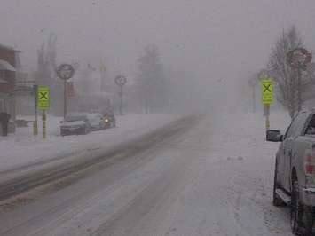
Environment Canada has issued snow squall watches for Sarnia-Lambton and London-Middlesex, where up to 15cm of snow is possible on Saturday.
Meteorologist Geoff Coulson says the coldest temperatures we've seen so far this winter will come across relatively warm Lake Huron, to hit areas northeast of Chatham-Kent.
"Because this activity will be very localized, people could be driving around Saturday morning with sunny skies, then drive into one of these intense bands of snow, and have to cope with winter driving conditions," he says.
The squalls are expected overnight Friday and could persist throughout Saturday. But Coulson adds Windsor-Essex and Chatham-Kent should be relatively safe.
"If this wind had been right out of the north, the activity could have punched inland. But we're expecting the wind to come in from the northwest," he says.
Coulson adds temperatures should return to normal next week.


