The Lower Thames Valley Conservation Authority is warning residents that strong winds and high water levels in the region could lead to flooding.
A flood watch has been issued for Rondeau Bay and the Lake Erie shoreline that will last until Friday. Sustained winds from the east on Wednesday could raise lake levels in the Rondeau Bay area an additional 10 to 20 cm. Waves on the lake are expected to reach two metres in height by Wednesday evening.
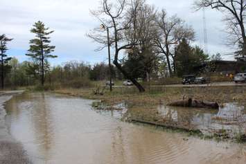
"If the forecasts hold, there could be flooding on the bay side of Erieau to a greater extent than that observed last week. There could also be flooding in other communities around Rondeau Bay such as Shrewsbury, Rondeau Bay Estates, Rose Beach Line and Erie Shore Drive, as well as in flood-prone areas further west around Wheatley," the LTVCA said in a statement issued Tuesday. "There is a risk that wave action could damage shoreline protection works and cause shoreline erosion.
A strong wind warning has also been issued by Environment Canada for areas around Lake Erie. Winds from the east are expected to pick up strength Wednesday morning and are expected to be above 40 kilometres per hour with gusts of up to 65 kilometres per hour
Over the next few days, strong winds will be driving waves onto the Lake Erie shoreline in Chatham-Kent and Elgin County. There is a risk that wave action could damage shoreline protection works and cause shoreline erosion.
"People should take extra caution and avoid the shoreline," the LTVCA said. "There could also be hazardous debris within the waves and water which could be thrown onto the shoreline. Standing water can also present unseen hazards. Children and pets should be kept away from the water."


