We are heading into a slippery weekend with the potential for difficult driving conditions.
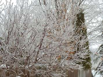
A slow moving system will bring freezing rain and ice pellets to our area early Saturday morning. Snowfall warnings and freezing rain warnings are in effect.
Periods of mixed precipitation, mainly ice pellets, freezing drizzle or snow are expected for later Saturday and Saturday night.
Freezing rain Sunday morning will change to rain through the day Sunday, and it could be heavy at times.
Ice accumulations combined with a gusty wind could result in power outages due to fallen tree limbs and power lines.
Across northern Bruce and Grey counties, heavy wet snow will start Friday night. Snowfall amounts near 10 cm are possible by Saturday morning.
Another round of snow and ice pellets will affect the area Sunday into Monday with additional accumulations possible. A few hours of freezing rain are also possible Sunday night into Monday morning.
Several local conservation authorities are watching the weekend weather system closely.
Saugeen, Ausable Bayfield, and Maitland Valley Conservation Authorities have all issued condition statements with the watersheds at risk of minor flooding with about 80 mm of precipitation.
Ice jams are not a concern and no major flooding is expected.
The Grand River Conservation Authority has issued a flood watch for parts of its watershed. Rainfall totals could reach upwards of 90 mm, based on the current forecast.
Flood Coordinators are monitoring conditions in areas around Drayton, Grand Valley, New Hamburg, and Ayr.