Another winter storm system is taking aim at Midwestern Ontario, with snow and possible freezing rain expected late Wednesday into Thursday.
Significant amounts of snow are possible late Wednesday into Thursday across a large portion of southern Ontario due a strong low-pressure system. Environment Canada has upgraded a special weather statement to a winter storm warning for north Huron County, north Perth County, Bruce County, Perth County, and north Wellington County. The special weather statement remains in place or south Huron County and south Perth County.
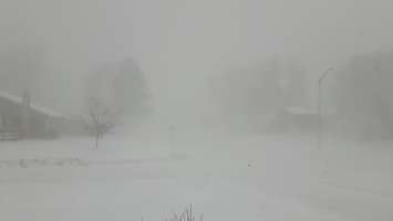
Visibility will be poor as a result of the heavy snow and local blowing snow, Environment Canada warned.
Hazardous travel conditions are likely Wednesday evening into Thursday morning. Motorists are urged to consider postponing non-essential travel until conditions improve.
Most of Midwestern Ontario, including Bruce, Grey, Northern Wellington, Northern Huron and Northern Perth counties, could see between 20 and 40 cm of snowfall. At this point, the path of the low pressure system is still uncertain which will affect exact snowfall amounts.
In South Huron and South Perth, it's also possible that snow will transition to freezing rain or rain late Wednesday night or Thursday morning. We could see about 15 cm of snow fall, with the risk of freezing rain. However, it's also possible the system will track further south, meaning precipitation will remain predominantly snow, and significantly higher amounts will be possible.


