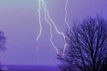
Environment Canada issued a special weather statement for Sarnia-Lambton late Friday afternoon warning of a potentially stormy Saturday. The national weather agency is watching a line of strong to severe thunderstorms that has developed over Wisconsin. The storms are expected to move rapidly eastward and cross southern Ontario overnight and early Saturday morning. There could be potential for strong wind gusts, frequent lightning, hail and torrential downpours. There's the chance thunderstorms could become severe again Saturday afternoon and night as the humidex builds to near 40 C in advance of a sharp cold front. After a high of 31 C (88 F) Saturday, the temperature isn't expected to rise above 20 C (68 F) Sunday.
Environment Canada Meteorologist Geoff Coulson reminds us that lightning is a threat in any thunderstorm.
"That is a concern I think for people going out and doing outdoor activities," says Coulson. "It's a good idea to stay on top of the latest forecast for any watches and warnings that may be in effect from Environment Canada. While big thunderstorms produce big hail, damaging winds, flash floods and on occasion tornadoes, these events are relatively rare. But, they do happen from time to time in the southwest during this time frame."
Coulson says it's always a good idea to remind people of this lightning safety rule, "when thunder roars, go indoors!"
He says if you're close enough to hear thunder, lightning is close enough to be dangerous.
-With files from Melanie Irwin


