Environment Canada forecasts that snow squalls are expected to develop with lake effect snow likely beginning tonight and continuing Sunday.
Under the snow squall bands, visibilities will be significantly reduced due to the heavy snow combined with blowing snow, and snow will quickly accumulate.
Much colder arctic air blasts in over the mild waters of the great lakes tonight and Sunday. As a result, conditions will quickly become favourable for snow squalls to develop tonight and continue through Sunday.
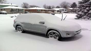
Local snowfall amounts in the heaviest snow squalls of 10 to 20 cm are expected overnight and Sunday. In addition, strong and gusty northwest winds will whip up freshly fallen snow, resulting in sudden very low to at times nil visibility in blowing snow.
There is a possibility that a strong snow squall off of Lake Huron may become nearly stationary across the region Sunday into Sunday night. If this happens, local snowfall amounts of 20 to 30 cm are possible by Monday morning.
Driving conditions will quickly deteriorate tonight after the flurries and snow squalls arrive. Motorists should consider adjusting their travel plans accordingly.