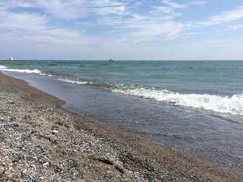
Water levels on lake Erie and St. Clair are the lowest they have been in five years but are still above average, according to Lower Thames Valley Conservation Authority.
Average daily levels on Lake Erie at the beginning of September were around 174.52 metres. This was down about 35 centimetres from last year’s peak daily average water level record set on July 21.
The all-time record high monthly average for September was 174.87 m, set in 2019. Water levels at the beginning of September were still 33 cm above what would be considered normal for the month.
“Water levels on Lake Erie peaked in June and are now into their seasonal decline,” the LTVCA said. “Forecasts suggest water levels could drop around 13 cm by the beginning of October.”
The average daily water levels on Lake Erie at the start of the month were 173.52m, which is a drop of about 35 cm from last year’s peak daily average water level record set on July 17.
With the lower water levels, officials said the risk of flooding along the shoreline has decreased.
Along the Lake St. Clair shoreline, it is expected that sustained gale force winds above 60 kilometres per hour would now be needed to produce shoreline flooding.
For the Lake Erie shoreline, some areas are also looking at wind speeds closer to gale force before flooding occurs.
“While significant flooding has not been seen for several months now down on Erie Shore Drive, this may have more to do with the lighter winds seen over the last few months,” the LTVCA said. “Current water levels on Lake Erie are only a centimetre below what was seen last winter when flooding was still being seen in the area.
Shoreline residents are still being asked to pay attention to local conditions as flooding could still occur along the road.