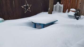
Sarnia-Lambton is digging out after an intense storm system dumped up to 20 centimetres, eight inches of windblown snow Monday night and Tuesday morning.
Environment Canada meteorologist Geoff Coulson said a large scale moisture-laden system came up from the Gulf of Mexico.
"We've seen general snowfall amounts right across southwestern Ontario of 15 to 20 centimetres, with some locally higher amounts, and lake-effect snow adding more to that in parts of Lambton County today," said Coulson. "And yet another potential large scale snowfall expected later in the day Thursday into Friday morning from yet another system coming from the Gulf of Mexico."
The snowfall warning ended for Sarnia-Lambton Tuesday morning but it was replaced by a snow squall warning.
"The main system has moved off to the east but we are seeing in the north winds coming in off Lake Huron some pretty good lake-effect snow. We could see another 10 centimetres to 15 centimetres of snow locally."
Coulson said it's been a very cold month of February but there are signs of moderating temperatures next week.
The City of Sarnia declared a significant weather event Tuesday due to substantial snow accumulation and ice formation on roadways and sidewalks.
The public is asked not to park on city streets during plowing activities and not to deposit snow on roads or sidewalks.
Public Works Manager Tony D'Agostini said roads were being cleared with priority given to main streets and bus routes.
"The crews will be working all day and throughout the night, possibly until tomorrow, before we can get to all the streets," he said.
West Region OPP reported several collisions Tuesday morning and again urged drivers to slow down and adjust to changing conditions.