The Essex Region Conservation Authority first issued a flood watch along the shores of Lake Erie and Lake St. Clair on May 30, and now it is extending it until June 28.
It said current lake levels have exceeded records set in 1986, and they are expected to remain high into July.
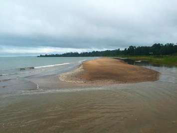
"Current lake levels are approximately the same starting elevation, before wind and waves, as the original shoreline hazard mapping completed in 1976," said Water Resources Engineer James Bryant. "The region has experienced nine flood events this spring with the most impacted area being east Leamington, and more specifically, the shoreline between Point Pelee National Park and the Town of Wheatley."
Because of high water levels, it does not take much for the wind to push lake water on land. The water has also weakened shoreline infrastructure, creating a greater risk to shoreline communities.
"Updated mapping is required to best protect the residents of the region from the ongoing impacts of flooding and erosion," said Bryant.
The authority continues to monitor conditions and advises residents to pay attention to flood messaging.